
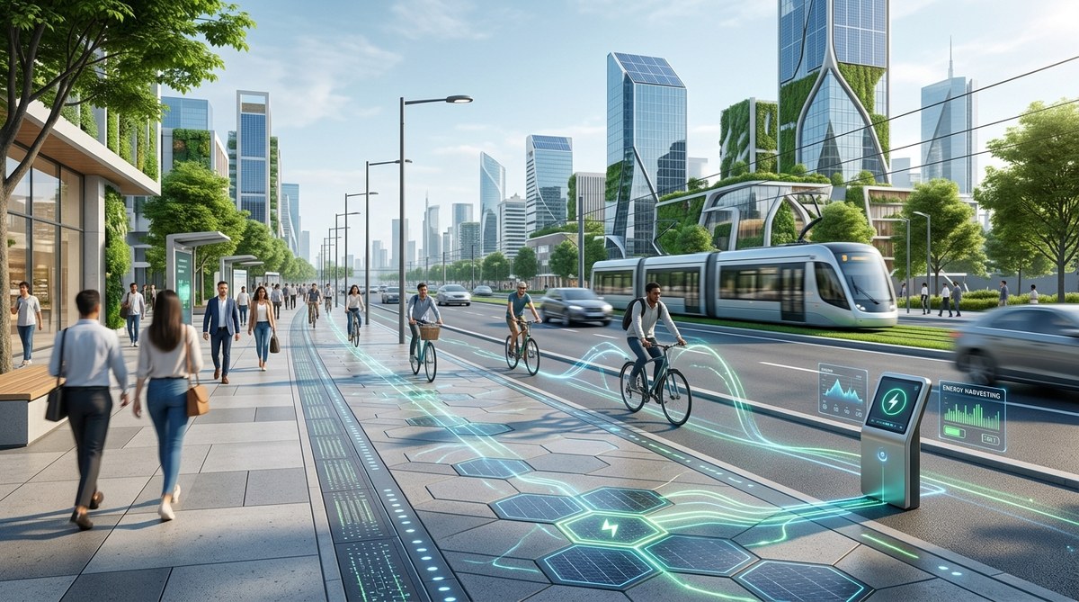
Picture a city district where walking feels natural, safe, and even joyful. Where the street is designed for people first and vehicles second. This is the promise of smart city pedestrian flow design in 2026. For decades, urban planners have centered car traffic in their layouts. But a shift is happening. New technologies, data analytics, and a deeper understanding of human behavior are making it possible to design districts that truly prioritize the pedestrian. This article offers a practical, evidence-based guide for urban planners, architects, and municipal officials who want to reduce car dependency and build vibrant, walkable communities.
Designing for pedestrian flow in 2026 requires a layered approach. You must combine smart sensor networks with thoughtful street geometry. Use real-time data to adjust signal timing and sidewalk widths. Integrate green infrastructure to make walking pleasant. Prioritize ground floor retail that invites foot traffic. The goal is to create a system where walking is not just possible, but the most logical and enjoyable choice for short trips.
Why Pedestrian Flow Deserves a Smarter Approach
Car traffic is easy to measure. We count vehicles per hour, measure delay, and optimize signal timing. Pedestrian flow is more complex. It involves movement patterns, dwell times, and human comfort. In 2026, the tools available to measure and shape this flow are better than ever. Cities that ignore pedestrian design face congestion, poor air quality, and declining street life. Those that embrace it see higher property values, stronger local businesses, and healthier residents.
The challenge is that most existing design guidelines still favor the car. A typical street cross-section allocates 60 to 70 percent of space to vehicles. Changing this ratio requires political will, community buy in, and a solid data driven strategy. The good news is that cities like Paris, Barcelona, and Portland have already shown it works. Their success is not just about removing cars. It is about using smart technology to create a dynamic environment that adapts to how people actually move.
A Six Step Process for Pedestrian First Districts
Implementing a pedestrian flow design strategy does not happen overnight. It requires a systematic process. Here is a numbered list of steps your team can follow.
-
Audit existing movement patterns. Before you design, you need to know how people currently move through the area. Use anonymized mobile data, video analytics, and on the ground surveys. Identify pinch points, popular crossing locations, and areas where pedestrians feel unsafe. This baseline is critical for measuring success later.
-
Set clear performance metrics. Define what success looks like. Common metrics include average walking speed, dwell time in public spaces, number of people crossing a street per hour, and the ratio of pedestrian space to vehicle space. Tie these to health and economic outcomes. For example, a 10 percent increase in foot traffic can correlate with a 5 percent rise in retail sales.
-
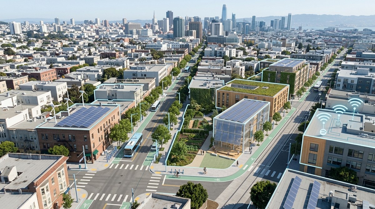
Redesign street geometry for people. This is where the physical layout changes. Narrow travel lanes. Widen sidewalks. Add curb extensions at intersections to shorten crossing distances. Create dedicated bus and bike lanes to separate modes. Use materials and textures that signal to drivers they are entering a pedestrian zone.
-
Deploy smart sensors and adaptive signals. Install IoT sensors that count pedestrians in real time. Use this data to adjust pedestrian crossing signals. In a smart district, the walk signal can extend automatically if a crowd is waiting. This reduces frustration and keeps people moving. The same sensors can detect near misses and alert traffic engineers to dangerous spots.
-
Layer in green infrastructure and amenities. People walk more when the environment is pleasant. Add trees for shade, benches for resting, and public art for interest. Rain gardens and permeable pavements manage stormwater while making the street feel more like a park. Lighting should be warm and even, with no dark corners.
-
Iterate based on data. After construction, continue monitoring. Pedestrian behavior changes over time. Use the data to tweak signal timings, add seating where people linger, or widen a path that gets crowded during lunch hours. The smart city is a learning system.
Techniques That Work and Mistakes That Hurt
Not all design choices are equal. Some techniques reliably improve pedestrian flow. Others look good on paper but create problems in practice. The table below compares effective strategies with common mistakes.
| Technique | How It Works | Common Mistake |
|---|---|---|
| Curb extensions (bump outs) | Shorten crossing distance and improve visibility between pedestrians and drivers. | Creating extensions that block drainage or interfere with bike lanes. |
| Pedestrian scrambles (diagonal crossings) | Allow people to cross in all directions at once, reducing wait times. | Using them at intersections with high turning vehicle volume, which causes conflicts. |
| Adaptive signal control | Adjusts walk times based on real time pedestrian presence. | Setting the maximum wait time too long, which encourages jaywalking. |
| Shared streets (woonerfs) | Remove curbs and signs, forcing all users to negotiate space at low speeds. | Designing them without clear entry points, confusing drivers and creating unsafe speeds. |
| Raised crosswalks | Elevate the crossing to sidewalk level, slowing cars and increasing pedestrian visibility. | Installing them without proper drainage, leading to ponding at the crossing. |
Expert Advice on Getting the Details Right
“The most successful pedestrian districts are not just about removing cars. They are about creating a rhythm of movement that feels intuitive. Use data to understand the pulse of the street. Then design the physical space to support that rhythm. If you get the geometry right, the technology just makes it work better.” — Dr. Maria Chen, Director of Urban Mobility at the Institute for Sustainable Cities.
This insight is crucial. Technology alone cannot fix a poorly designed street. But when the geometry is right, smart sensors and adaptive controls can make a good design great. The rhythm Dr. Chen mentions comes from understanding peak hours, school arrival times, and local event schedules. A district near a university will have a different flow pattern than one near a hospital. Your design must respond to the specific context.
Building a Toolkit for Pedestrian Flow
To make pedestrian flow design work in 2026, you need a set of core tools and strategies. Here is a bulleted list of essential elements to include in your planning toolkit.
- Real time pedestrian counting sensors. Use thermal cameras or LiDAR to count people without privacy concerns. These sensors work in all weather and can distinguish between pedestrians, cyclists, and vehicles.
- Digital twin simulations. Before you build, create a digital twin of the district. Run simulations of pedestrian flow under different scenarios. Test how a farmers market or a street closure affects movement.
- Dynamic wayfinding signage. Install digital signs that show walking times to key destinations. Update them in real time based on current conditions. This encourages people to choose walking over driving.
- Smart street furniture. Benches with integrated charging ports, trash cans that signal when they are full, and planters that collect rainwater. These features make the street more usable and reduce maintenance costs.
- Open data dashboards. Share pedestrian flow data with the public. This builds trust and allows residents and businesses to make informed decisions about where to walk or open a shop.
For a deeper look at how data analytics can support these efforts, read our article on harnessing data analytics for smarter urban infrastructure design. You can also see how smart urban solutions are transforming cityscapes of the future.
Addressing Common Concerns
Urban planners often face pushback when they propose reducing car space. Residents and business owners worry about congestion and delivery access. Here is how to address those concerns with evidence.
Concern: “Fewer car lanes will cause gridlock.”
Response: In most cases, reducing car lanes does not increase overall travel time. This is called induced demand in reverse. When you provide less space for cars, some drivers switch to other modes, and overall traffic volume drops. Data from cities that have implemented road diets shows that travel times often stay the same or improve for remaining drivers because traffic flow becomes more consistent.
Concern: “Delivery trucks need access.”
Response: Design specific loading zones that are separate from pedestrian paths. Use time restricted delivery windows, such as early morning hours. Smart loading dock management systems can schedule deliveries to avoid conflicts with peak pedestrian times.
Concern: “People will just drive to another district.”
Response: That is actually the goal. You want to create a district where walking is the best option for trips under one mile. For longer trips, provide excellent transit connections and bike infrastructure. The pedestrian district becomes a destination, not a pass through.
Measuring Success in 2026
You cannot manage what you do not measure. For pedestrian flow design, track these key indicators over time.
- Mode share: The percentage of trips made by walking, biking, transit, and car in the district.
- Pedestrian level of service: A rating that considers sidewalk width, crowding, and delay at crossings.
- Safety data: Number of pedestrian involved crashes and near misses.
- Economic vitality: Retail vacancy rates, sales tax revenue, and property values.
- Public health: Rates of physical activity and air quality measurements.
If you want to understand how these metrics fit into a larger framework, check out our piece on 7 smart city benchmarks that measure true sustainability in 2026.
A Final Word on Making It Happen
Designing a smart city district that prioritizes pedestrian flow over car traffic is not a fantasy. It is a practical, achievable goal in 2026. The technology exists. The design principles are proven. The benefits are clear. What it takes is a commitment to shifting the priority from vehicles to people. Start with a small pilot project. Measure everything. Show the results. Then scale up. Every great walkable neighborhood started with a single block. Yours can too.

Leave a Reply