
“`markdown
Cities across the United States are facing sharper storms, hotter heat waves, and aging infrastructure that buckles under pressure. For urban planners, the question isn’t whether to act. It is how to act with limited budgets and rising expectations. Smart technology offers a path forward. When applied with care, these tools help neighborhoods bounce back faster and grow stronger together.
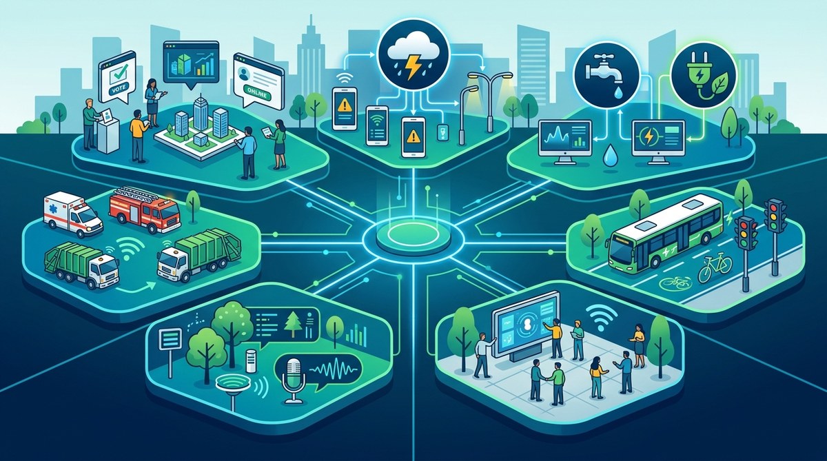
Community resilience depends on more than concrete barriers and backup generators. Smart technology gives urban planners real-time data, predictive tools, and direct communication channels to prepare for disruptions. This article outlines seven practical ways to weave these tools into resilience planning, from early warning sensors to community wifi networks that keep everyone connected when it matters most.
Why resilience needs a smarter toolkit
Resilience used to mean building higher seawalls and stockpiling supplies. Those steps still matter. But in 2026, communities expect more. They want neighborhoods that can adapt, communicate, and coordinate during a crisis. Smart technology turns static infrastructure into responsive systems.
Think about a flash flood. Traditional planning relies on historical rainfall data that may be years old. Smart sensors measure rainfall in real time and send alerts directly to residents. That shift from reactive to proactive saves lives. The same principle applies to power grids, traffic systems, and public health monitoring.
Urban planners who adopt these tools are not replacing human judgment. They are amplifying it. Let us walk through seven specific ways to make that happen.
1. Deploy IoT sensors for early warning and real-time monitoring
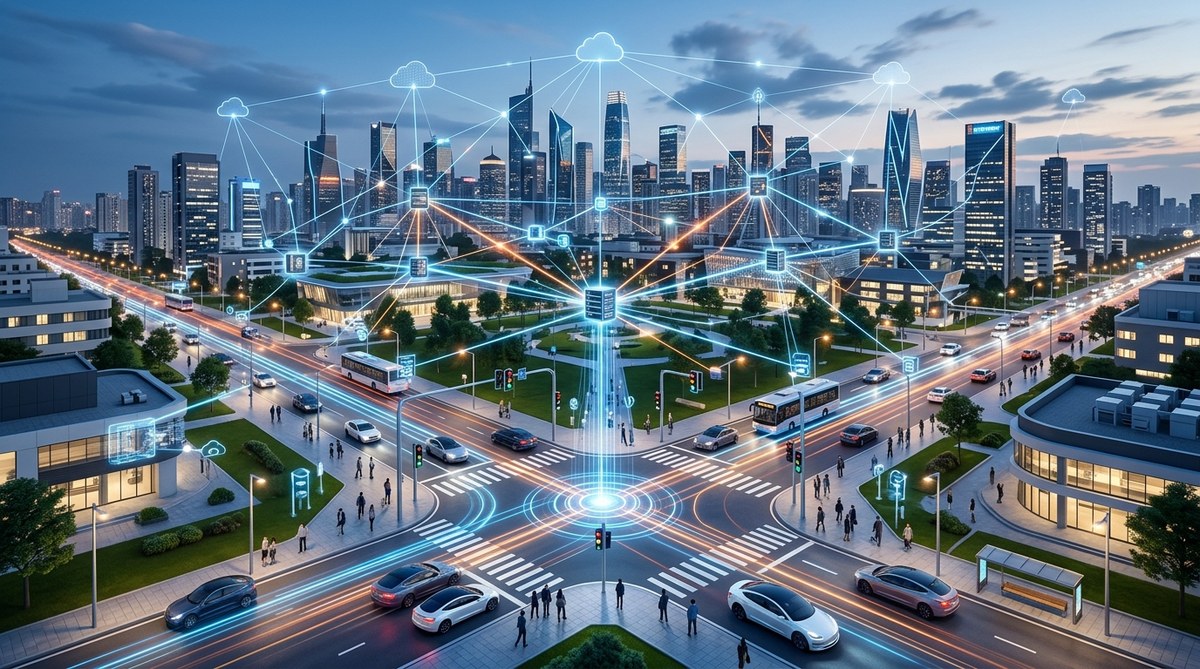
The Internet of Things (IoT) is the nervous system of a smart city. Small, affordable sensors placed across a neighborhood can track air quality, water levels, ground stability, and structural integrity. They send data to a central dashboard where planners can see trouble brewing before it arrives.
A practical example: In 2025, Miami deployed flood sensors at 200 intersections. When water reaches a threshold, the system automatically updates navigation apps and triggers barricade lights. Residents get push notifications to avoid flooded routes. The result is fewer stranded drivers and faster emergency response.
For urban planners, the process looks like this:
- Identify the top three climate risks in your district (flooding, heat, wildfire, etc.).
- Map where past incidents have hit hardest using local records.
- Select sensor types that match those risks (water level, temperature, vibration).
- Partner with local utilities or universities to pilot 20 to 30 units.
- Use open data standards so different systems can talk to each other.
- Train community members to interpret dashboard alerts.
- Review sensor data quarterly to adjust response plans.
This approach turns guesswork into evidence. For a deeper look at how sensors support infrastructure monitoring, see our guide on how to leverage IoT sensors for real-time urban infrastructure monitoring.
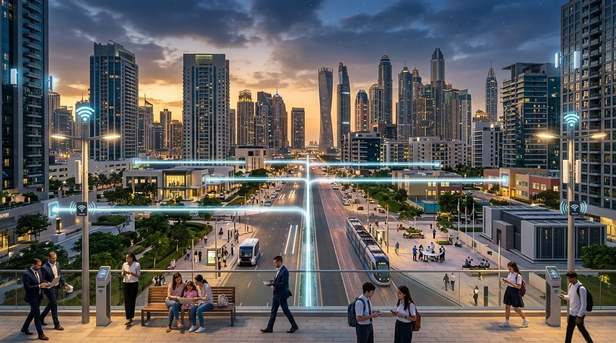
2. Build community wifi networks that stay online during emergencies
Internet access is no longer a luxury. It is a lifeline. When hurricanes knock out cell towers, residents lose access to emergency updates, FEMA applications, and virtual healthcare. A resilient community needs connectivity that survives the storm.
Cities like New Orleans have started investing in mesh wifi networks. These systems do not rely on a single central hub. Each node can route data through neighboring nodes. If one goes down, the network heals itself. During Hurricane Francine in 2024, a mesh network in the Lower Ninth Ward stayed operational for 72 hours after the main grid failed.
Key elements of a resilient community wifi strategy:
- Place nodes on community centers, libraries, and schools.
- Use battery and solar backups to keep nodes running.
- Partner with local internet providers for reduced rates on public access points.
- Create a simple map that residents can access offline before a storm.
- Offer digital literacy training at senior centers so everyone can use the network.
This is not just about hardware. It is about trust. When people know they can stay connected, they are more likely to stay put or evacuate with confidence. Learn more about how smart city dashboards are revolutionizing urban planning in 2026 and how connectivity plays a role.
3. Use digital twins to simulate disasters before they strike
A digital twin is a virtual model of a physical city. Planners feed it real-time data from sensors, traffic cameras, and weather stations. Then they run simulations. What happens if a tornado hits this block? Which evacuation route gets clogged first? Where should emergency supplies be staged?
The city of Tulsa, Oklahoma built a digital twin in 2024 to model tornado scenarios. The simulation revealed that three key intersections would become gridlocked within 15 minutes of a warning. Planners adjusted traffic light timing and added directional signage. When an EF2 tornado touched down in 2025, evacuation times dropped by 22 percent compared to previous events.
Digital twins are powerful, but they require good data. Start small. Model a single neighborhood or a specific corridor. Prove the value before scaling citywide. For more on this, check out our article on are digital twins the key to smarter infrastructure maintenance in 2026.
4. Create a shared data hub for emergency coordination
During a crisis, information flows fast and often in conflicting ways. The fire department has one map. The water utility has another. The school district has its own system. Valuable time gets lost reconciling these sources.
A shared data hub solves that. It is a centralized platform where all city departments, utilities, and relief organizations post updates in a common format. The hub uses open APIs so existing software can feed into it without custom coding.
Here is a comparison of traditional coordination versus a data hub approach:
| Factor | Traditional coordination | Shared data hub |
|---|---|---|
| Update frequency | Manual, every 2-4 hours | Automatic, every 60 seconds |
| Data sources | 5 to 8 separate systems | 20+ systems unified |
| Public access | Limited to press releases | Real-time dashboard for residents |
| Cost to maintain | Moderate (staff time) | Moderate (cloud hosting) |
| Training needed | Minimal | Moderate for setup, low for use |
| Accuracy during chaos | Declines under pressure | Stays consistent |
Planners should start by inviting three departments to participate. Expand once the system proves its value. A good model comes from the Los Angeles Emergency Management Department, which launched a unified data hub in 2024 and saw cross-agency response times improve by 30 percent.
5. Install smart street lighting that adapts to emergencies
Street lights do more than light the way. Modern LED fixtures can act as wifi hotspots, air quality monitors, and emergency broadcast points. When paired with motion sensors, they can brighten automatically if a person is walking alone at night, then dim when the street is empty to save energy.
During emergencies, smart lights become a communication tool. Some cities have installed speakers and LED displays on light poles. If a wildfire threatens a neighborhood, the lights can flash a specific color and broadcast evacuation instructions in multiple languages.
A 2025 pilot in Phoenix used smart street lights to warn residents about extreme heat. When temperatures passed 110 degrees, lights near bus stops flashed a cooling station symbol. The system directed people to the nearest air-conditioned shelter. Usage of those shelters increased by 40 percent during the pilot.
For a closer look at how lighting projects cut costs and improve safety, see 5 smart street lighting projects that cut energy costs and improve safety.
6. Integrate renewable microgrids into critical facilities
A power outage during a disaster can turn a bad situation into a deadly one. Hospitals, emergency shelters, and water treatment plants need reliable electricity. Renewable microgrids offer a solution. These are local energy systems that can disconnect from the main grid and operate independently using solar, battery storage, or small wind turbines.
Urban planners can identify which facilities in their district are most critical. Then they can prioritize those for microgrid installation. The microgrid does not need to cover 100 percent of the facility’s energy use. Even covering life safety systems, lighting, and communication equipment makes a difference.
In 2024, the city of Asheville completed a solar-plus-storage microgrid at its main emergency shelter. When Hurricane Helene knocked out regional power for five days, the shelter stayed lit and cool. Residents could charge phones and power medical devices. The system paid for itself within two years through reduced energy bills and avoided generator fuel costs.
Learn more about this approach in our article on integrating renewable energy microgrids into smart city planning.
7. Launch a citizen alert platform with two-way communication
Most emergency alert systems are one-way. A message goes out. Residents receive it. But what if residents need to report a downed power line, a missing person, or a flooded street? A two-way platform lets them send information back to planners and first responders.
This is not a replacement for 911. It is a supplemental channel for non-life-threatening updates. Platforms like this have been used in Seattle since 2023, where residents can text a hotline number with photos and GPS coordinates of hazards. The city’s operations center logs each report and routes it to the correct department.
“The most resilient communities are the ones where residents feel like partners, not just recipients of services. Two-way technology makes that partnership possible.” – Dr. Elena Torres, director of urban resilience at the University of Texas at Austin
For urban planners, setting up this system involves three layers:
- Layer 1: Intake. A simple text line or app form where residents submit reports.
- Layer 2: Triage. Automated routing based on keywords and location.
- Layer 3: Response. A dashboard for city staff to acknowledge and update each report.
Add a public status board so residents can see that their report was received and what action is being taken. That transparency builds trust. For more on citizen engagement, read can citizen engagement platforms truly shape smarter city planning.
Common mistakes urban planners make with smart resilience tools
Even well-intentioned projects can go wrong. Here are five pitfalls to watch for:
- Installing sensors without a plan for maintaining them. Dust, weather, and curious animals can disable a sensor within months.
- Buying proprietary systems that lock you into one vendor. Open standards give you flexibility and lower costs over time.
- Ignoring digital equity. If senior citizens and low-income households cannot access the technology, the system is incomplete.
- Overloading residents with alerts. Too many notifications lead to alert fatigue. People stop paying attention.
- Building a system that no one knows how to use. Training for both staff and residents is not optional.
Planners who avoid these mistakes see higher adoption rates and better outcomes during real emergencies.
The broader picture: connecting resilience to sustainability
Community resilience and sustainability go hand in hand. A neighborhood that reduces its energy demand, manages stormwater naturally, and grows local food is also better prepared for disruption. Smart technology can support both goals at once.
For example, smart irrigation systems save water during droughts while also preventing runoff during floods. Green roofs equipped with moisture sensors reduce urban heat while alerting maintenance crews when they need care. These overlapping benefits stretch every dollar further.
To see how these ideas connect, explore our piece on implementing green roofs and urban gardens to boost city sustainability and integrating smart technologies for efficient urban planning.
Practical steps to get started this quarter
You do not need a million dollar grant to begin. Here is a realistic sequence for any mid-sized city:
- Audit your current resilience plan. Where are the gaps? Which risks keep you up at night?
- Pick one neighborhood with a high risk profile and engaged community groups.
- Install 10 to 20 sensors for the most pressing hazard (flood, heat, or air quality).
- Set up a simple dashboard using free or low-cost open source software.
- Run a tabletop exercise with local emergency managers using data from the sensors.
- Invite feedback from residents through a town hall or survey.
- Document what worked and share it with neighboring communities.
Each small success builds momentum for larger investments later. You do not have to do everything at once.
A smarter path forward for every community
Smart technology is not a magic fix. It will not stop a hurricane or prevent an earthquake. But it can make the moments after those events less chaotic, less lonely, and less dangerous. For urban planners in 2026, the tools are ready. The data is waiting. And the communities you serve are counting on you to connect the dots.
Start where you are. Use what you have. And keep asking the people in your city what they actually need. That human question, paired with smart technology, is what builds real resilience.

Leave a Reply